![]()
![]()
![]()
![]()
![]()
![]()
![]()
![]()
![]()
![]()
![]()
![]()
![]()
![]()
![]()
![]()
![]()
![]()
|
|
|
|
Moose Mountain - Bragg Creek Elbow Falls Area
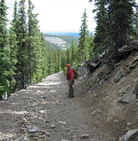
Start of the trail from parallel parking spot, angle parking is to the left
Nice road to hike on
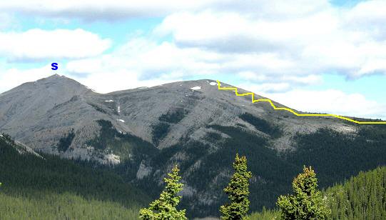
S - Moose Mountain summit, trail curves around west then up the switchbacks
Finally approaching the switchbacks at the base of Moose Mtn
Once above the switchbacks you see the summit block
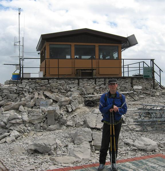
On the summit, very nice spot!
A friend to share my Caramel Peanut Fusion Power Bar with
A view from the top
Summit block trail as we head back, a great hike! Moose Mountain Scramble: Class 1 – Steep Hiking Altitude: 2,437 m (7,995 ft) Ascent Time: 2 Hours give or take 30 mins Elevation Gain: approx. 477 m (1,565 ft) 7km one way 14km return Best Season to Scramble: May 15 to September – Shell road closed in winter from Dec 1 to May 14th Highlights This fairly long hike brings you to the Moose Mtn fire lookout and provides a very scenic view on a clear day. The foursome, Banded Peak, Outlaw Peak, Mt. Cornwall and Mt. Glasgow can be seen to the Southwest. Getting There Head out to Bragg Creek and onto highway 66 towards Elbow Falls. Around 14 km down highway 66 you will see on your right a sign for the Paddy Flat’s campground. The next right (approx .8 km) past the sign for Paddy Flat’s campground is the Shell Canada maintained road up to the Moose Mtn trailhead. This turnoff is unmarked. Follow this gravel road for around 7+ kilometers to the trailhead. Route Description The trailhead has spots for angled parking and parallel parking. The trail heads north on an old road drops about 60 metres in elevation then levels out before slowly rising and curving around west to the initial switchbacks on the lower slopes of Moose Mountain. Once above the switchbacks it levels out and you dip down slightly before coming to the summit block. At the summit block the trail ascends on the left side and brings you to the fire lookout.
|