Home
| Skerries
| Northern
Ireland | Northern
Ireland | Donegal
| Donegal
| Donegal
| Westport
| Clifden
| Galway
| Bunratty
| Kenmare
| Kenmare
| Kenmare
| Goleen
| Cahir
| Glendalough
| Dublin
| Map | B&Bs
| Links
Day 6 - Tuesday, May 14, 2002
OK, now the weather sucks. Roaring winds and rain slapped
at our windows as we wiped our tired eyes. This was not looking good. We
stumbled downstairs and our host seemed a bit surprised to see us up as early as
8:30 AM. We had forgotten to make an appointment for breakfast the night before
and he scurried around wildly (yet unnecessarily) to get our breakfast to us. It
seems he has taken over running the B&B and is studying to be a chef. At the
time, his wife and daughter were on holiday and he was on leave from his job as
an electrician to work on his studies. The breakfast was quite good. We looked
out at the harbor and the pouring rain as we ate and wondered what would become
of the day. This was making up for all the great weather we had on previous
trips.
We went back upstairs and lounged around for a while.
Finally, we decided to put on rain gear and go for a 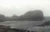 drive. The wind was still
enough to blow us all the way back to Dublin, but the rain was a bit less. We
started out deciding not to go far and took the little road that the B&B was
on out to the end of the little peninsula. We made it out to the end and found
ourselves on a road that made a U-Turn almost impossible. Somehow I managed
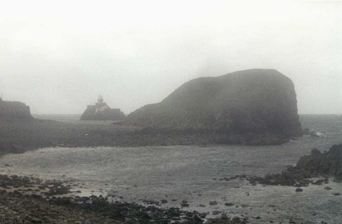
about a 75 point turn and we started some more wandering. There is a small
lighthouse at the mouth of the harbor with was quite pretty, but taking a
picture of it in the gale force winds proved to be a challenge. Finally we
decided we had seen all that the weather would let us see in that area, so we
headed back towards the B&B.
drive. The wind was still
enough to blow us all the way back to Dublin, but the rain was a bit less. We
started out deciding not to go far and took the little road that the B&B was
on out to the end of the little peninsula. We made it out to the end and found
ourselves on a road that made a U-Turn almost impossible. Somehow I managed
about a 75 point turn and we started some more wandering. There is a small
lighthouse at the mouth of the harbor with was quite pretty, but taking a
picture of it in the gale force winds proved to be a challenge. Finally we
decided we had seen all that the weather would let us see in that area, so we
headed back towards the B&B.
By the time we got there, the sun was starting to come out,
so we decided to continue west. We took the coast road to Kilcar which, as I said, was spectacular, but once again, very
narrow. What a beautiful drive. We stopped to talk to a sheep herder but
realized he only spoke Gaelic. The town of Kilcar is very pretty, but we were on
a mission to get to see some cliffs so we continued on. We stopped at the
Cul-a-Duin on the way the the Slieve League cliffs to see if any music was
planned for the evening. One of the owners said "we won't know until people
show up to play". I like that philosophy, but it's hard to plan your
vacation around it. We told him we were going to Slieve League and he said
"I hope you make it back". The winds were still VERY strong, but we
didn't know the half of it. We headed towards the cliffs anyway. Here are some
directions:
coast road to Kilcar which, as I said, was spectacular, but once again, very
narrow. What a beautiful drive. We stopped to talk to a sheep herder but
realized he only spoke Gaelic. The town of Kilcar is very pretty, but we were on
a mission to get to see some cliffs so we continued on. We stopped at the
Cul-a-Duin on the way the the Slieve League cliffs to see if any music was
planned for the evening. One of the owners said "we won't know until people
show up to play". I like that philosophy, but it's hard to plan your
vacation around it. We told him we were going to Slieve League and he said
"I hope you make it back". The winds were still VERY strong, but we
didn't know the half of it. We headed towards the cliffs anyway. Here are some
directions:
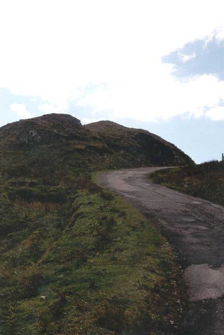
From Carrick, take the road south at the Slieve League Pub
to Teelin. This is, by the way, the road to the Cul-a-Duin pub. The trick is, DO
NOT turn at the sign to Slieve League. Instead, turn at the Bunglass road.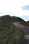 Don't
be fooled by the closed gate at the car park as we were at first. It appears you
must walk from here. Rather, just open the gate, drive through and close it
after you. There is a car park at the top too. Not that this isn't a nice walk,
but clearly, in the winds that we were fighting, Felicity wasn't going to make
it and I wasn't having any fun. After we had been walking for a few minutes, a
car passed us, so Felicity, turned around and decided she would try to get
through the gate. By the time she got down and back to me, I had traveled a good
distance and had almost been blown off a cliff. The winds were clearly much
worse here. She gave me a ride to the top, one of her only driving experiences
in Ireland. I was very glad to be a passenger.
Don't
be fooled by the closed gate at the car park as we were at first. It appears you
must walk from here. Rather, just open the gate, drive through and close it
after you. There is a car park at the top too. Not that this isn't a nice walk,
but clearly, in the winds that we were fighting, Felicity wasn't going to make
it and I wasn't having any fun. After we had been walking for a few minutes, a
car passed us, so Felicity, turned around and decided she would try to get
through the gate. By the time she got down and back to me, I had traveled a good
distance and had almost been blown off a cliff. The winds were clearly much
worse here. She gave me a ride to the top, one of her only driving experiences
in Ireland. I was very glad to be a passenger.
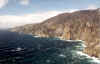 From the car park at the top, there is a very well marked
path to the first summit. Oddly, the view of the cliffs from the path is better
than the view from the summit. Still, it's worth the climb, though maybe not on
that day. Once again, Felicity wisely decided to get out of the wind and I
climbed to the summit. There were two other couples there when I arrived and
they were ready to make a quick retreat. The couple I tried to speak to only
spoke German, but we understood each others feelings. The wind must have been
gusting around 100 mph. As I stood directly into it, the noise in my ears was
deafening. It was all I could do to stand up. I too, stayed only for a few
minutes and began my descent in a hurry. On the way down, I passed a couple and
we took each others pictures. I warned them about what they were headed for and
they, being as foolish as I, headed on up the trail.
From the car park at the top, there is a very well marked
path to the first summit. Oddly, the view of the cliffs from the path is better
than the view from the summit. Still, it's worth the climb, though maybe not on
that day. Once again, Felicity wisely decided to get out of the wind and I
climbed to the summit. There were two other couples there when I arrived and
they were ready to make a quick retreat. The couple I tried to speak to only
spoke German, but we understood each others feelings. The wind must have been
gusting around 100 mph. As I stood directly into it, the noise in my ears was
deafening. It was all I could do to stand up. I too, stayed only for a few
minutes and began my descent in a hurry. On the way down, I passed a couple and
we took each others pictures. I warned them about what they were headed for and
they, being as foolish as I, headed on up the trail.
From the trail and car park we could see Rathlin O'Birne
(or O'Beirne as I believe it is correctly and sometimes spelled) in the
distance. This is the only place in Ireland that I know of that my name can be
found as a place name. It is believed that members of my clan settled the island
for a short time. We would get closer to it later.
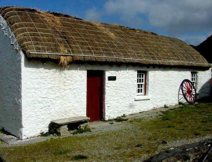
We went from there on to Glencolmcille. It was
disappointing that we didn't have more time
to explore the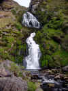
 area, but the weather had done us in. We went through the folk village, which
was enjoyable and then wandered out towards Malin Beg. From there, we were very
close to Rathlin O'Beirne. We decided to head for Ardara and have some dinner.
We ate dinner at the pub at the local hotel. Guinness and Beef
again....fabulous stuff. Of course, the evening drive had to follow so we went
out to a nearby beach and watched the sunset and had just
area, but the weather had done us in. We went through the folk village, which
was enjoyable and then wandered out towards Malin Beg. From there, we were very
close to Rathlin O'Beirne. We decided to head for Ardara and have some dinner.
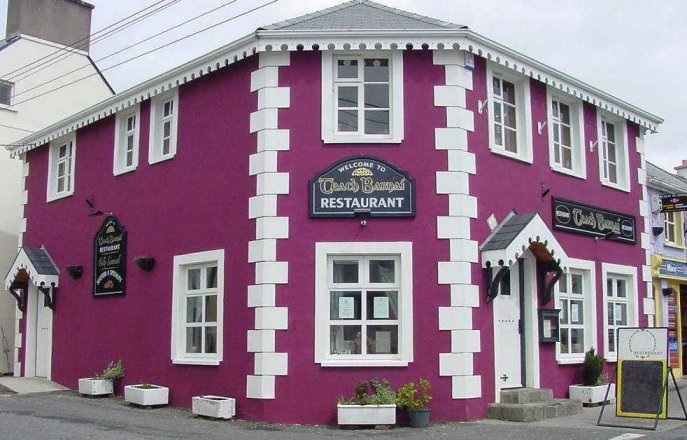
We ate dinner at the pub at the local hotel. Guinness and Beef
again....fabulous stuff. Of course, the evening drive had to follow so we went
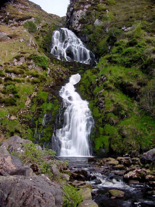
out to a nearby beach and watched the sunset and had just 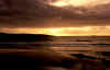 enough light left to
enjoy a waterfall down the road. We got back to Killeybegs after dark with
another very full day under our belt.
enough light left to
enjoy a waterfall down the road. We got back to Killeybegs after dark with
another very full day under our belt.
More
Photos
Home
| Skerries
| Northern
Ireland | Northern
Ireland | Donegal
| Donegal
| Donegal
| Westport
| Clifden
| Galway
| Bunratty
| Kenmare
| Kenmare
| Kenmare
| Goleen
| Cahir
| Glendalough
| Dublin
| Map | B&Bs
| Links
[ Back ] [ Next ]
 drive. The wind was still
enough to blow us all the way back to Dublin, but the rain was a bit less. We
started out deciding not to go far and took the little road that the B&B was
on out to the end of the little peninsula. We made it out to the end and found
ourselves on a road that made a U-Turn almost impossible. Somehow I managed
about a 75 point turn and we started some more wandering. There is a small
lighthouse at the mouth of the harbor with was quite pretty, but taking a
picture of it in the gale force winds proved to be a challenge. Finally we
decided we had seen all that the weather would let us see in that area, so we
headed back towards the B&B.
drive. The wind was still
enough to blow us all the way back to Dublin, but the rain was a bit less. We
started out deciding not to go far and took the little road that the B&B was
on out to the end of the little peninsula. We made it out to the end and found
ourselves on a road that made a U-Turn almost impossible. Somehow I managed
about a 75 point turn and we started some more wandering. There is a small
lighthouse at the mouth of the harbor with was quite pretty, but taking a
picture of it in the gale force winds proved to be a challenge. Finally we
decided we had seen all that the weather would let us see in that area, so we
headed back towards the B&B.