Heart Mountain - Canmore Bow Valley
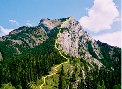
Route up the North West ridge of Heart Mountain, Heart Creek is in
the valley to the right
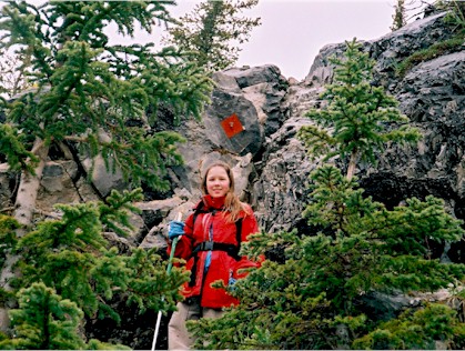
Emily showing the way at the moderate rock step
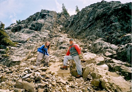
Use of hands on some portions of the upper slopes
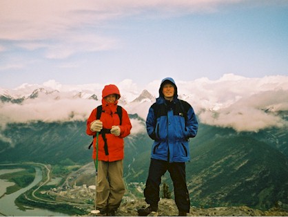
Made it! A cool day for Emily and Al but the java tasted good!
Heart Mountain – Canmore Bow Valley
Scramble: Class 2 – Steep Hiking, Some Use of Hands
Altitude: 2,135m (7,003 ft)
Elevation Gain: 875m (2,870 ft)
Ascent Time: 1 1/2 – 2 1/2 Hours
Best Season to Scramble: May to October
Highlights
This scramble because of its easterly location escapes much of
the snowy weather that Banff and Lake Louise get. Although its right next to the
TransCanada highway and you can hear some road noise, the terrain covered to the summit is
varied and interesting.
Getting There
Head west out of Calgary on the TransCanada highway # 1 to the
Lac Des Arc overpass (approx 71.7km from the Canada Olympic Park intersection to the Lac
Des Arc overpass). Take the overpass and off ramp to head back east on the TransCanada for
.5km for the Heart Creek parking lot or .7km for the guardrail and ditch right at the
Creek itself.
Route Description
From either spot make your way over to the East side of the
creek and the trail will lead you to the very direct route up the Heart Mountain ridge.
About two thirds of the way up you need to ascend a moderate step with a reddish orange
diamond in the rock wall marking the spot. See also photo for this scramble. There is also
some use of hands further up the slope. The general rule is keep to the left on the ridge
as you go up.
When you top out, most people stop here, have their snacks and enjoy
the view, however the true summit albeit only marginally higher is still another 20
minutes farther back along a ridge walk. There is also a semi-circle ridge traverse to the
east from the summit, which comes out approx. one km east of Heart Creek. I’ve done
this but found it a bit of a plod.
