These free trips are made possible by our dedicated crew of volunteer trip leaders and the generosity of our members and advertisers. Questions? Call trip leaders (evenings unless noted), program coordinators Gwen or Doug Whitbeck, evenings at (603) 878-9046, or the MRWC office at (978) 275-0120. Be sure to read 1. What to Bring and What to Know. Want to help? Become a member today!
** REGISTRATION FOR THE JULY 22 CANAL TOUR MUST BE MADE BY JULY 5
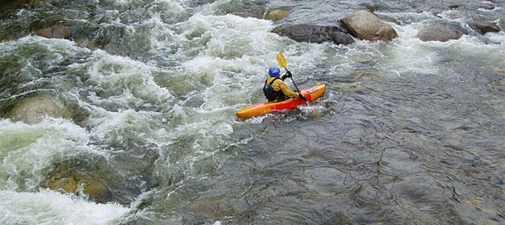
July 1 (Saturday) -- MERRIMACK RIVER, Manchester (MODERATE) S2S - Registration Required
This moderate trip can offer a challenge but one worth taking. Starting in the urban historical factory section of Manchester, class II rapids will be encountered before entering a more remote section which passes a lock that has survived from the Old Middlesex Canal System.
Meet 9:00am in Manchester, NH. Rte 293 to exit 6 (Amoskeag Bridge). Before crossing river, turn right into Amoskeag Fishway parking lot. Leader: George May (603) 883-3409, email: georgemay@adelphia.net Trip Partner: NH Rivers Council.
July 8 (Saturday) -- MERRIMACK RIVER, Merrimack (EASY) S2S - Registration Required
This is the beginning of the flat reach of the river and many signs of our rich history are still in evidence along the river. This trip is highlighted by seeing the remains of the lock and canal system described by Henry David Thoreau in his, “A Week on the Concord and the Merrimack River”.
Meet 9:00am in Merrimack, NH. From south, take Everett Turnpike to exit 12 (Bedford Rd, northbound exit only); right onto Bedford Rd. Right onto Rte 3; first left (Depot Street) to end. Leader: Chuck Mower (603) 424-1200. Trip Partner: NH Rivers Council.
July 9 (Sunday) -- SOUHEGAN RIVER, Amherst (EASY)
Enjoy a leisurely paddle on a stretch of the Souhegan that is mostly flatwater or swift water with views of trees, meadows, birds and perhaps other wildlife (usually including a few golfers).
Meet at 10:00am in Amherst, NH. Everett Turnpike (Rte 3) to exit 7W (Rte 101A west), then after 7.5 miles take right onto Rte 122N. Launch is on north side of bridge by country club. Leader: Rich Hart (603) 673-5128, email: harts@ultranet.com. Trip Partners: Souhegan Watershed Association and NH Rivers Council.
July 15 (Saturday) MERRIMACK RIVER, Nashua (EASY) S2S - Registration Required
Kathy Hersh, the Director of Community Development in Nashua will be our guest speaker.
A flatwater section which at one time passed only fields and meadows. They are joined by residential and commercial establishments.
Meet at 9:00am in Nashua, NH. From the south take the Everett Turnpike to exit 7E, at top of exit go
straight on Henri Bourque Highway to end , take a right on Concord then take the 4th left onto Hills Ferry Road to the end which bears left and becomes Cassandra Lane. Take first right and pass over railroad tracks before taking another right onto a dirt road. Continue to boat ramp. Leaders: Julie Smith (603) 891-0267, email: cantdog@comcast.net, Linda Gogolin (603) 880-5447.
July 16 (Sunday) MERRIMACK RIVER, Tyngsboro (EASY) S2S - Registration Required
This section offers flatwater and quickwater. There are more signs of human habitation from Tyngsboro to North Chelmsford. The river is followed by the railroad. A number of interesting old stone bridges and culverts span small tributaries.
Meet at 9:00am in Tyngsboro, MA. From the north, Rte 3 to exit 35 , (Rte 113), at top of exit go right over highway, continue to Rte 3A intersection, continue straight crossing the Tyngsboro bridge. Bear left on Frost Rd, left into the “old” Tyngsboro Campground at 76 Frost Rd. From the south, Rte 3 north to
Exit 34, right onto Westford Rd.. left at lights at the bottom of the hill onto Middlesex Rd., (Rte 3A). Take next right crossing over the Tyngsboro bridge, bear left onto Frost Rd., left into the “old” Tyngsboro Campground at 76 Frost Rd. Leader: Gary Watson (978) 455-6876, email: gwatson6876@comcast.net.
July 22 (Saturday) -- MERRIMACK RIVER, Lowell/Dracut (EASY- MODERATE) S2S - Registration Required
Merrimack by canal and by river
At Pawtucket Falls in Lowell, the Merrimack drops 30 feet over the course of a mile. In the 18th and 19th Centuries, a network of canals were dug, first to enable transportation around the falls, then later to harness the power of the falls. On this trip, we will start our river tour on the canals wi th a National Park Service canalboat tour, with a park ranger covering the history of the canals and the importance of the Merrimack.
Then we'll paddle our own boats from the foot of Pawtucket Falls downstream to the Dracut-Methuen line. We will enjoy a few short spots of fun and easy whitewater (suitable for boaters of all abilities), which soon settle down to gently flowing water with pretty riverbanks. To be included on the canal boat tour, reservations are required by July 5, and there is a $9/person fee (less for seniors and students).
Meet at 9:30 AM at the National Park Visitor Center parking lot on Dutton Street, opposite Broadway Street. Route 3 to 495 north to the Lowell Connector. Then take Exit 5A, Thorndike Street. Go under the Connector, under the next overpass and follow the road as it bears to the right. The parking lot is on the right at the next set of lights after the American Textile History Museum.
Because this trip is in conjunction with the Lowell National Historical Park, the exact time and location may vary, so please call the trip leader. Trip leader: Tom Hood, (978) 764-1685, kayaker@honeybear.com.
July 29 (Saturday) -- CONCORD RIVER , Concord (EASY)
From history to wildlife – join us for an easy paddle which passes under the Old North Bridge replica, (part of the Minute Man National Historical Park), then proceeds through the Great Meadows National Wildlife Refuge.
Meet 9:00am in Concord, MA, at Lowell Road bridge. From Rte 3 take Rte 62 to Concord Commons. Lowell Rd is on west side of Colonial Inn at north end of Commons. Leader: Julie Smith (603) 891-0267, email: cantdog@comcast.net.
July 30 (Sunday) -- MERRIMACK RIVER, Lawrence (EASY TO MODERATE) S2S - Registration Required
This trip begins and ends in urban areas, but the views from the river during much of the remainder of the trip are similar to those of the wilderness of northern New England. The river is generally wide and slow moving for more than ten miles of the trip. Views of the Lawrence mill buildings along the first half-mile of river will give you a new perspective of their size.
Meet 9:30am at boat ramp below dam in Lawrence, MA. Rte 495 to exit 41B, Rte 28 north for 1.75 miles to bridge over Merrimack. Cross RR tracks, then before traffic lights take right between factory buildings.
River access is behind Pacific Paper Products building. Leader: Bill Valentine (603) 893-5006, email: k1wv@yahoo.com.
July 29 - 30 (Saturday – Sunday) -- MERRIMACK RIVER OVERNIGHT, Boscawen (EASY) S2S Registration Required was originally scheduled for June 10 – 11 and was rescheduled to July 29 – 30 due to weather conditions.
Enjoy this beautiful remote section of the Merrimack, which meanders through varied countryside. Jump from the rope swing and camp on one of the sandy beaches. This section can also be shortened to a day trip by taking out shortly after the Hannah Dustin Memorial. Please advise the trip leader if you’re doing this as a day trip.
Meet at 9:30am in Boscawen, NH. Rte 93 to exit 17, Rte 4W four miles to Rte 3N, 3 ½ miles to ramp marked “Merrimack County Boat Access” on right just past prison. Bring camping gear and food for overnight. Leaders: Nancy Gero (603) 895-0274, email: coolcanoechic@comcast.com, and Ted Krzesowski (603) 329-8168, email: tedkrz@mailaka.net. Trip Partner: NH Rivers Council.