|
|
|
Gainesville Trails San Felasco Mountain Bike Trails
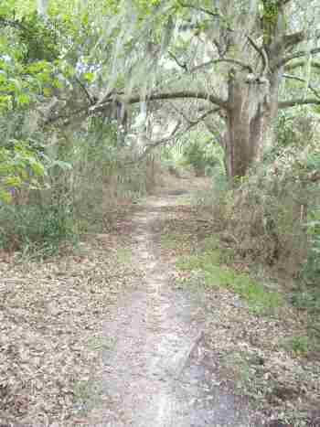
Terrain: About 15 miles of well maintained trails. All trails are marked and are good for all skill levels, though there's moderate elevation change on the longer Tung Nut route. This is a true cross-country course. No hunting / no alcohol / no overnight camping / entry fee $2 per person--annual passes available from Devil's Millhopper (see below). Skill To Get There: Take I-75 to US 441 in Alachua, which is the first exit just north of Gainesville. Turn East and head south on US 441, cross an overpass, and turn right at the Progress Center industrial park. From Gainesville, take 13th Street north (it is also US 441) for about 10 miles. Turn left at the industrial park (Progress Center). Follow the Progress Center road to its end, where it becomes unpaved. Pass the restrooms and follow signs to parking under the trees. A tremendous amount of volunteer work has culminated in the establishment of these trails on the northern outskirts of Gainesville, open from 8:00am to sundown. The trails opened late August of 2001 and these trails are truly multiuse in that they offer hiking, jogging, cycling, and equestrian trails. I saw bird watchers, hikers, and cycling families using the trails together. There are several well-marked loops to choose from. The shortest of these is the one mile Cotton Tail loop, good for warming up or novice riders. The intermediate route is fairly easy and good for all skill levels. The longest loop (Tung Nut) offers ample log crossing opportunities, rolling hills, and a few technical sections. Determined novice riders can comfortably tackle these trails. Equestrian trails are completely separate from other trails, except at a few intersections. Please yield the right of way. Topographic map available here: www.topozone.com/map.asp?z=17&n=3294512&e=357127&s=25&size=m&symshow=n San Felasco Hammock Preserve Office (7:30am -
4:00pm weekdays): 386 462-7905
Hailes Trails Terrain: Smooth flowing trail with steep little hills and some technical challenges. Private property is open only twice a year. Skill To Get There: Take I-75 to Gainesville and head West on Newberry Road (SR26) for about 8 miles, right on NW 202, and left on NW 46th Avenue at the end of the road. Less than a quarter mile on left. Private property is open only for mountain bike race weekends. However, even if you don't race it is a fun course to ride. The best day to ride is Saturday, but the course is still open after the race Sunday afternoon. The loop is well marked and flows well with a few steep hills. The trails navigate through a quarry, so there is some elevation change and some rocky sections. Check www.goneriding.com for dates that the trails are open. Small admission fee per person.
High Springs BMX Track Terrain: Uhhh... it's a BMX track! Lots of jumps! To Get There: Exit I-75 at High Springs, and head towards High Springs. The address is 100 N.W. 11th Avenue, High Springs, Florida, 32643. The place is open only during certain times and days. Please see http://www.hsbmx.com/ for the latest schedule.
Paved Rails to Trails Terrain: The trail is Florida Flat and is paved. The trail is flanked by pine woods and a prairie. Pretty cool in any case. Skill To Get There: Take I-75 to Gainesville and head East on Newberry Road. Continue on Newberry road (which turns into University Avenue) for about 6 miles, past the University of Florida and downtown. Turn right on S.E. 15th Street (Kincaid Road) and within 2 miles turn right at Boulware Springs. This trail is made for road cyclists or mountain bikers who can't afford a road bike (just kidding)! The Gainesville to Hawthorne trail is about 18 miles each way, and you can expect hikers, in-line skaters, and equestrians to be sharing the path. It is impossible to get lost and the riding is very easy. What more can you desire from an asphalt path? There are no technical sections and there are a few good stopping points that overlook Paynes Prairie. Though they've been modified, I constructed two information kiosks as my Eagle Scout service project while in Troop 71 in Gainesville when I was a kid. There's water and picnic areas at the park entrance and a porta-potty several miles into the trail!
More information is available from the local power company, Gainesville Regional Utilities.
"The Rock" Trails Terrain: Intermediate trails are narrow, full of roots, and have tight turns. Skill To Get There: Take I-75 to Gainesville and exit on Newberry Road (SR26), then head west for two miles. The trails are located on the south side of Newberry Road between the traffic signalized intersections of 98th Street and 122nd Street. The trails can be difficult to find for the first time since the entrance road has no sign! There is a sign that faces the street (as opposed to facing traffic moving along the road): "The Rock." The road curves to the right and park anywhere in the grassy area. You can click, pan, and zoom on the map below.
The trails are a little rough because they are new. There are tree stumps and roots to ride over and that's why I do not recommend beginners ride here. The best part about these trails is that they are almost inside city limits, so it is convenient for locals to take a quick trip. There is a four mile loop and a couple of laps will provide a good workout. However, more trails are planned. "Powerlines" Trails -- Not Recommended, will be developed for tract housing. Click Photos
Terrain: The trails are hilly for Florida! As it's informal name suggests, the trails run along a power line service road. These trails were popular in the decade of the 1990s, when "Loser" by Beck and Fiona Apple's "Criminal" were hits on the radio! Urban sprawl has closed these trails, but you can reminisce with "Bittersweet Symphony" by the Verve. To Get There: Take I-75 to Gainesville and head West on Newberry Road. Turn right on N.W. 98th Street and at the next traffic light (within one mile) turn right on 23rd Avenue. Park in the Fort Clarke Middle School parking lot. When you're on your bike, backtrack West on 23rd avenue and cross 98th Street. Follow the road till it turns into a dirt road and bike through the gate. Singletrack trails are to your left and right, just look carefully for them. Most are overgrown and neglected. Bring your machete. The Powerlines contain moderate climbs and descents--steep for Floridian standards. Just where the main dirt road turns 90 degrees you'll find more trails to your right. I can't point out every trailhead, but somewhere back there is a quarry to ride around. Bring your weed wacker if you hope to find the quarry. These trails are not for novices because you will need riding skills, orienteering skills, and trailblazing skills. There are many criss-crossing trails and you can easily get lost. The area is surrounded by neighborhoods and developers won this one.
Be friendly, courteous, and cautious on this privately owned land (except for a small portion of right-of-way). Poach at your own risk. |