Home
Map of Florida Trails
Links
Odds & Ends
My Bike
History

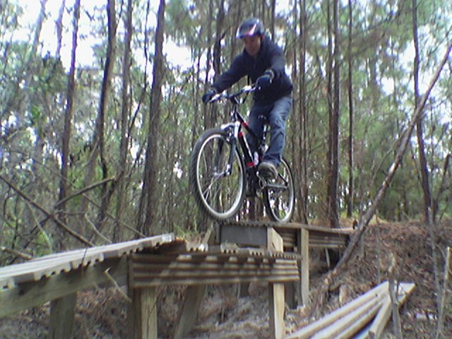
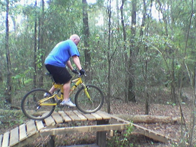
Jacksonville < Page 1 Page 2 >

Westside Regional Park

Terrain:  A short 5 miles of mixed trails consisting of two separate short loops.  Good for locals.

To Get There:  The entrance is across from the Jacksonville Naval Air Station on US17.  Take I-295 to US17 and head north.  Turn left (west) at the large jet parked at the entrance of the NAS.  You can click, pan, and zoom on the map below to help with directions.

There is a 2 mile single track loop in the back of the park. The front area is also about 2 miles with BMX style jumps, a few pallet bridges and a few drops.

Elevated Trail
Bridge


Downhill
Downhill
 

Bridge Crossing
Bridge Crossing
 

Log Crossing
Log crossing
 

Small Jumps
Log crossing
 

Another View of the Jumping Area
Log crossing

< Page 1 Page 2 >
 

Gainesville,GA, Dauset,GA, Macon,GA, Pensacola, Ft. Walton Beach, Tallahassee(3), White Springs, Jacksonville(2), St. Augustine, Gainesville(3), Ocala Bike Parks, Belleview, Pinellas County, Tampa(3), Alafia, Ruskin, North Port, Richloam and the Green Swamp, Withlacoochee State Forest--Citrus Section, Withlacoochee State Forest--Croom Section, The Grand Canyon, NE Orlando, The Little Big Econ State Forest, Rock Springs Reserve, Ocala National Forest--Paisley Woods, Lakeland, Seminole State Forest, Lower Wekiva Preserve, Flagler, Daytona Beach, Space Coast, Melbourne, Palm Bay, The Hal Scott Preserve, Bull Creek Conservation Area, Prairie Lakes State Reserve, Sarasota, Ft. Pierce, Stuart, Deerfield Beach, Fort Lauderdale, Sunrise, Hialeah, Miami(3), Florida City